Mount Pilchuck Fire Lookout - Best Washington State Hikes
The Mount Pilchuck fire lookout hiking trail is one of the most challenging yet rewarding hikes in Washington state. Although the hike is just 6 miles round trip, it ascends over 2,100 feet in elevation and leads to an old fire lookout with spectacular 360-degree panoramic views. Are you considering doing this hike? Read on for details, and check out the hiking vlog below to get a sense of what the trail is like.
Mount Pilchuck Trail Stats
Length: 6 miles, roundtrip (out and back)
Elevation Gain: 2,125 feet
Considered a hard and strenous trail.
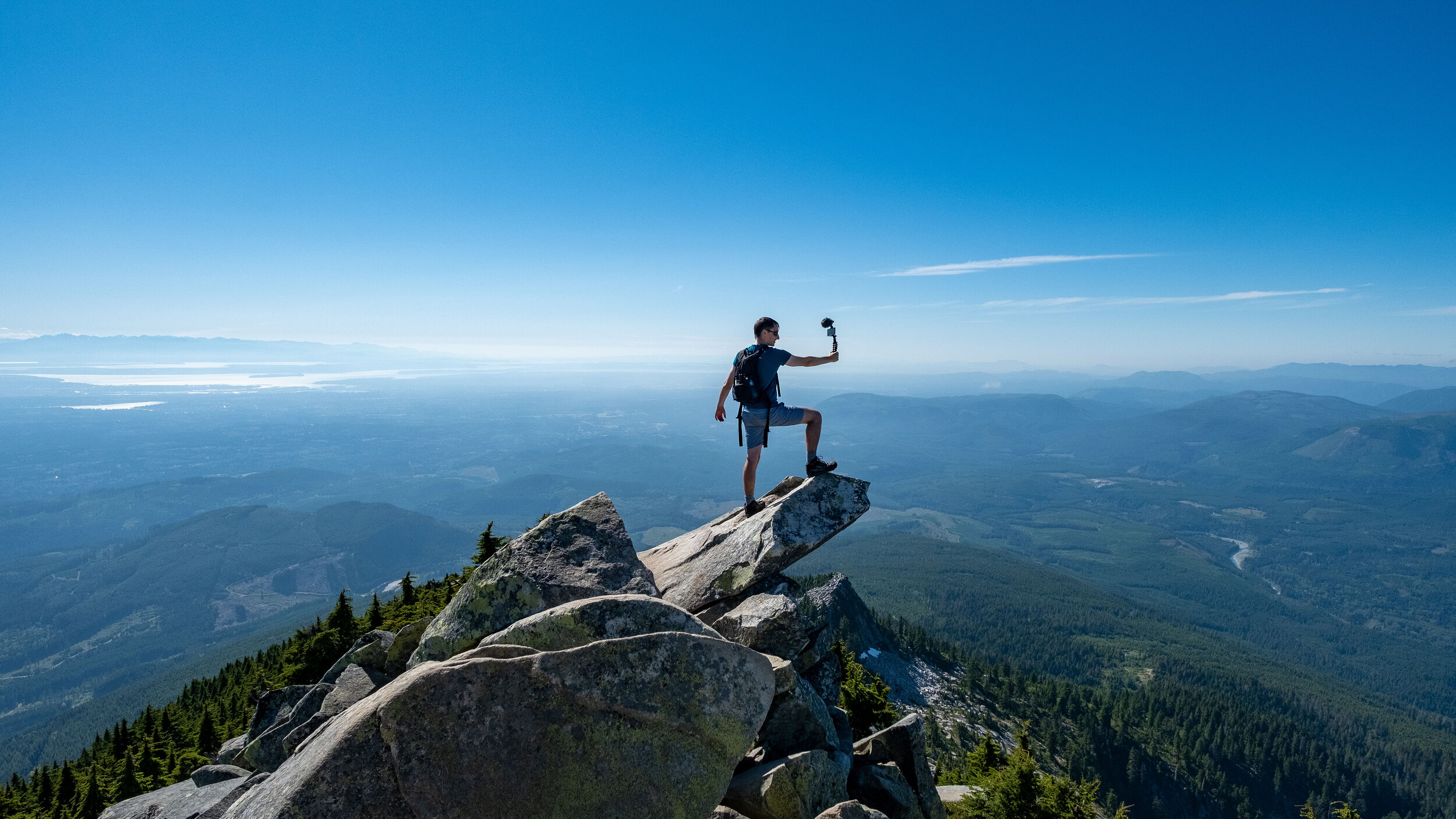
Mount Pilchuck fire lookout, your hiking trail destination.
Is Mount Pilchuck open?
As of July 2020, Mount Pilchuck is open for day hiking and overnight camping. Just know that there is only one outhouse toilet at the start of the trailhead, near the parking lot. There are no other official toilets or places to get water on this trail.
When to Visit
Before heading to any hikes in Washington, it’s wise to note the season and check the weather conditions. Mount Pilchuck in particular is best enjoyed from July through September or October. Not only is the weather warmer and more pleasant, but the snow should be melted by then. Standing at 5,341 feet tall, Mount Pilchuck receives a LOT of snow every winter. While you can still hike in the snow, the trail becomes much more challenging as you’ll need different hiking gear and a way to find the trail in the snow.
One way or another, check AllTrails and see what other hikers are saying about the trail and make sure the snow has melted.
What’s a fire lookout?
In case you don’t know, Washington state fire lookout hikes are among the best in the Pacific Northwest. Built during the 1900s after a series of forest fires, these lookouts are perched in high spots with panoramic views. There were once 750 fire lookouts in the state, but now that number is down to 93. The Mount Pilchuck fire lookout is one of the 93 that is still standing and open to the public.
Where is Mount Pilchuck?
Granite Falls is the closest town to Mount Pilchuck. This is where you can fuel up on gas, snacks, and food. From Seattle, it’s about an hour’s drive on I-5 North to Granite Falls; the area is east of Everett and Lake Stevens. Once you get to Granite Falls, drive east on the Mountain Loop Highway for about 45 minutes, and you’ll reach the trailhead for Mount Pilchuck.
Driving to Pilchuck
Fair warning: the road to Mount Pilchuck isn’t an easy one. And I’m not even talking about the hiking trail yet! The driving road is rough and full of potholes. If you’re visiting on a summer weekend, it will also be packed full of cars. It’s a (barely) two-way road that is often filled with overflow parking, so it can be hard to coordinate with drivers going against you. With that said, most people are nice and with a little communication, everyone can get by. A high-clearance vehicle is recommended to better take on the potholes. However, many small 4-door sedan take on this road just fine, so it’s up to your comfort level.
When driving, go past the first trailhead marker and parking lot. This is for Heather Lake, a much easier hike than Pilchuck that therefore receives more traffic. The road continues on for about 5 more miles. There are lots of potholes, but eventually, a smooth, paved road leads you the rest of the way. At the end of the road are a large parking lot, an outhouse toilet, and the Mount Pilchuck trailhead.
Recommended Hiking Gear
Trail conditions will vary. Because the beginning section is so shaded, the snow can take a longer time to melt, even when the weather heats up. As the temperatures burn up, the snow on top melts and trickles down below, so the trail can also be very wet and muddy. The trail becomes more difficult once you reach the boulder fields.
Due to these varying conditions, it’s best to hike with solid hiking boots that have ankle support, good grip on the soles, and water resistance. Our favorite hiking boots at the moment are Altra Lone Peak for men and for women; they’re super comfortable thanks to their wide toebox. Hiking poles are also recommended for navigating the rocky parts, and layers will keep you warm when you reach the top. If you plan to stay the night, be sure to bring essential camping gear.
The Hike
Like many hikes in Western Washington, this one starts out in a heavily wooded forest. You’ll stumble on a fork in the trail, so veer right towards a stream. From here on, there is sparse signage, but there are poles with small markers on occasion. Your best bet is to download the trail map to your phone from AllTrails, and double-check with other hikers on where the route is. There are many false summits, and the path can be easy to lose when you reach the boulder fields, so it’s important to be sure of your route. The climb in the forest is gradual and not terribly difficult, but there will be some rocks and tree roots to traverse.
About 1 mile in, you’ll reach a boulder field and the elevation will start to kick in. It will be boulders for the rest of the trail, which goes another mile until you reach the restored fire lookout that was originally built in 1921. Getting inside takes a bit of scrambling up some big boulders and a short ladder climb. It can be scary for some, but it’s not insanely difficult in good weather conditions.
The Views from the Top
The views from the fire lookout can be breathtaking. If you’re lucky to get a clear day, you’ll see Mount Baker, Mount Rainier, and the Olympics from the lookout. Just be warned that the area is prone to getting foggy and misty, so there’s a chance that the panoramic views won’t be visible. However, this can still be fun as fog can make for mysterious, intriguing imagery.
If you’re wondering, yes, you can camp at Mount Pilchuck. Camping reservations are not necessary.
Other Nearby Hiking Trails
Heather Lake Trail
If Mount Pilchuck sounds too daunting, or you want to tack on more mileage afterward, stop at Heather Lake. This is the trailhead you pass on the same road to Pilchuck. Heather Lake is a 5 mile long out and back trail with an elevation gain of 1,194 feet. It’s considered a moderate trail and it leads to a very pretty lake.
Lake 22 Trail
Another popular, moderate trail nearby goes to Lake 22. It’s a 7-mile long loop that includes a waterfall and a stunning alpine lake. There is a very gradual elevation increase (a total of 1,453 feet).
Big Four Ice Caves
If you’re seeking a short, easy trail, this is it. Just 3.2 miles long with an elevation gain of 488 feet, Big Four Ice Caves is a walk in the park. The trail isn’t difficult, and it leads to several ice caves. While the caves are fun to explore, be sure to not enter them as they could collapse at any time.
In Conclusion
Granite Falls is a great area north of Seattle that is full of hiking trails. From easy to difficult, there’s a trail here to suit the needs of just about any hiker.
If you liked this post, please share or pin it for later.