Best Campground in Washington - Hart's Pass
There are so many amazing campgrounds in Washington state, but the best campground (in our opinion) is Hart’s Pass. This forested campground is located near the Pacific Crest National Scenic Trail and there are tons lots of hiking trails in the area. It is also home to the highest and highest and most dangerous drivable road in Washington State, and the highest fire lookout in the state. Suffice to say, staying here is memorable in more ways than one.
In this guide, we’ll share where to stay overnight, things to do near Hart’s Pass, and most importantly, how to get there. If you’d like to watch the adventure unfold, check out our travel vlog of the whole experience below.
Where is Hart’s Pass?
Located in Okanogan County in the North Central part of Washington State (several hours away from Seattle), the nearest town to Hart’s Pass is Mazama. The wild west town of Winthrop is also nearby. If you’re looking for hotel accommodations, restaurants, grocery stores, and signs of civilization, these two towns are your best bets.
From Winthrop, drive west on Highway 20 for about 15 miles. Then turn right onto Lost River Road and drive for 7.5 miles. Eventually, the pavement will turn to gravel, and at this point, you’re on Hart’s Pass Road (NS-5400). Drive 13 miles on the road, and you’ll reach Hart’s Pass Campground.

The Most Dangerous Road in Washington
Hart’s Pass Road is the “most dangerous” road in Washington state for good reason. It’s a narrow gravel road with jagged, rocky walls on one side and a steep dropoff on the other. There are no guardrails, and no gas or service stations. And during the winter months, the road can be snowy and icy. Trailers are not allowed on this road, and while 2 wheel drive vehicles can make it, 4 wheel drive and high clearance is recommended.
When to Visit Hart’s Pass
The best time to visit Hart’s Pass and Washington state as a whole is the summer, ideally from July-September. This is when the weather is at its best — you will rarely find grey, cloudy days and the rain that Seattle is famous for. Instead, temperatures are mild, and the sun often shines brightly. Just be wary of possible fires in the area, and resulting smoke that may pollute the air and cloud views.
Where to Sleep
Hart’s Pass Campground has a handful of first come first served tent camping sites with adjacent parking spaces. It is $8 per night. If Hart’s Pass is full, other nearby campgrounds include Meadows, and Ballard and River Bend, both near Robinson Creek.
We spent 2 nights at Hart’s Pass campground during Labor Day weekend. Driving up on a Friday, we snagged a great campsite and saw lots of open spots around midday. By the end of the day, all of the sites were taken. There is no electricity, limited cell phone coverage, and running water and there are vault toilets, so plan accordingly.
What to Do at Hart’s Pass
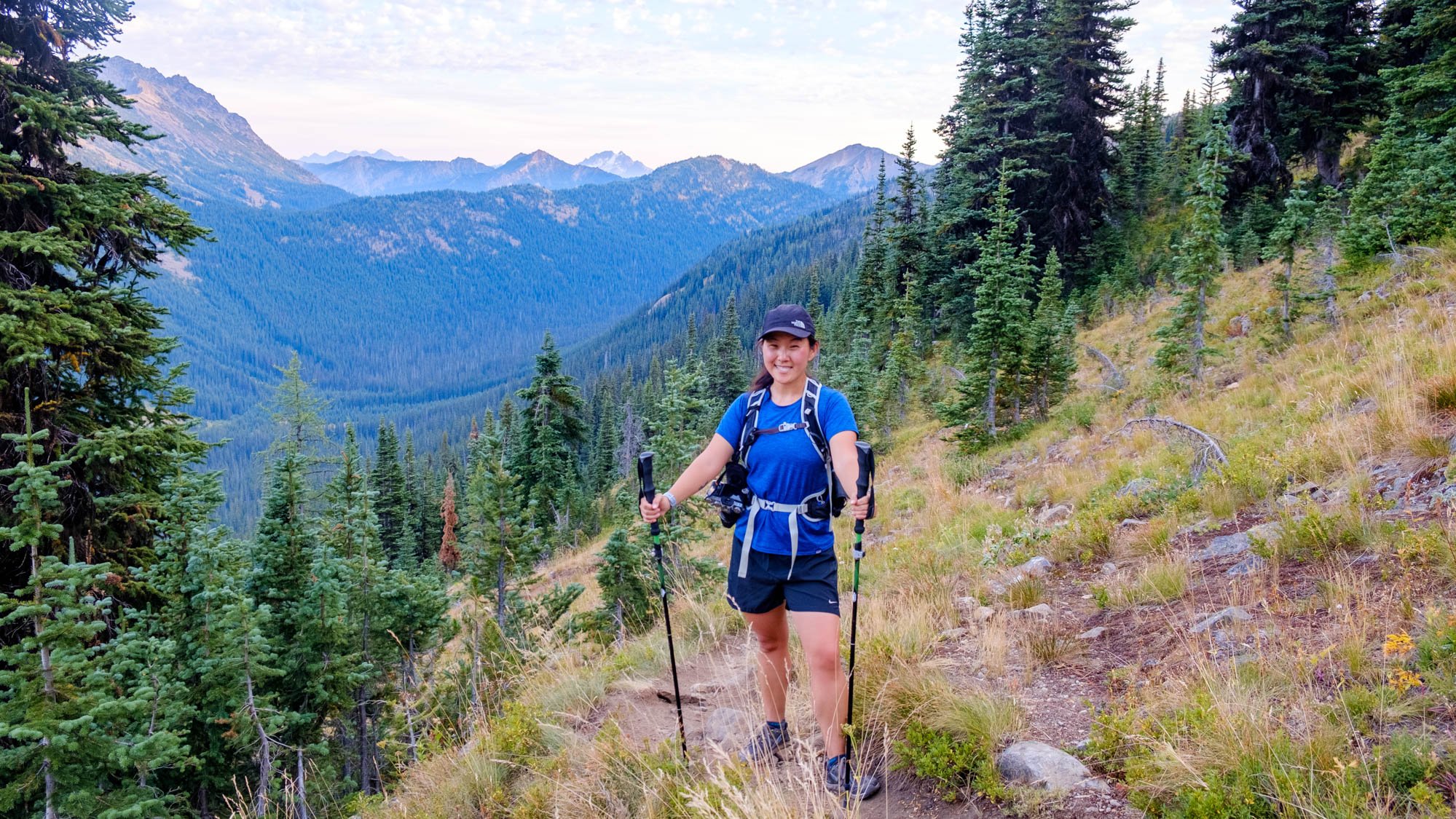
Given the campground’s proximity to the Pacific Crest Trail (PCT) hiking is a must-do while in the area. In case you’re unfamiliar with the PCT, it’s a 2,653-mile trail that begins at the US-Mexico border and ends at the US-Canada border. Hart’s Pass is just miles away from the end of the PCT. And the great part is that you can hike small sections of the PCT without having to do the whole thing. A few of our favorite hikes are listed below.
Hart’s Pass to Rainy Pass
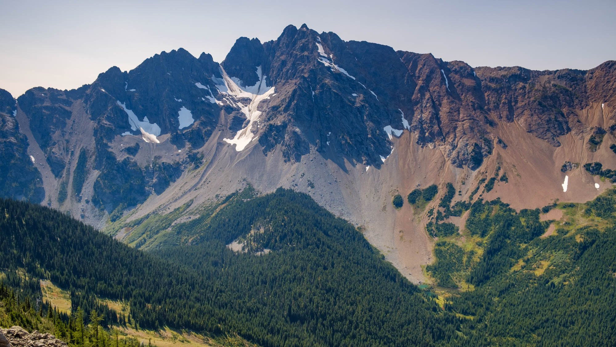
This is a 30 mile one-way trail, but you needn’t do the whole thing to get a taste of the natural beauty you’ll find on this trail. You can hop on the trail directly from Hart’s Pass campground. Or shave off 2.7 miles by driving to the end of Road 5400 to the PCT South Trailhead. We hiked 5 miles out to a stunning viewpoint of Azurite Peak, and hiked the 5 miles back, making a 10 mile round trip journey. This section of the trail was pretty flat, but with full sun coverage as there is very little shade. If you continue farther down the trail, there are more switchbacks and slightly steeper sections as there is a total of 3,800 feet elevation gain on this trail. There are also areas to stop and camp.

Buckskin Ridge to Silver Lake
Another nearby area to explore is the Pasayten wilderness, specifically the Buckskin Ridge Trail. Lasting 33.4 miles roundtrip, this hike goes roughly 5 miles through an alpine meadow, leading to Silver Lake. The journey to Silver Lake is stunning, with wildflowers or golden larches if visiting in the fall. Stop and camp at the lake, or continue on, but be ready for a challenge! The trail dips 5,800 feet, then ascends up to Silver Pass. It gets pretty treacherous, reaching a high point of 7,300 feet before reaching Buckskin Lake, or the terminating point, the Pasayten River.
Slate Peak Lookout
Driving Hart’s Pass Road will terminate just below Slate Peak Lookout. From the parking lot, it is a 10-minute uphill hike to Slate Peak, the highest fire lookout in Washington state. While the fire lookout itself is inaccessible, there is a big, flat area where you can take in 360 views of the mountain peaks making up the Cascade Range. It is a stellar place to enjoy sunrise or sunset.